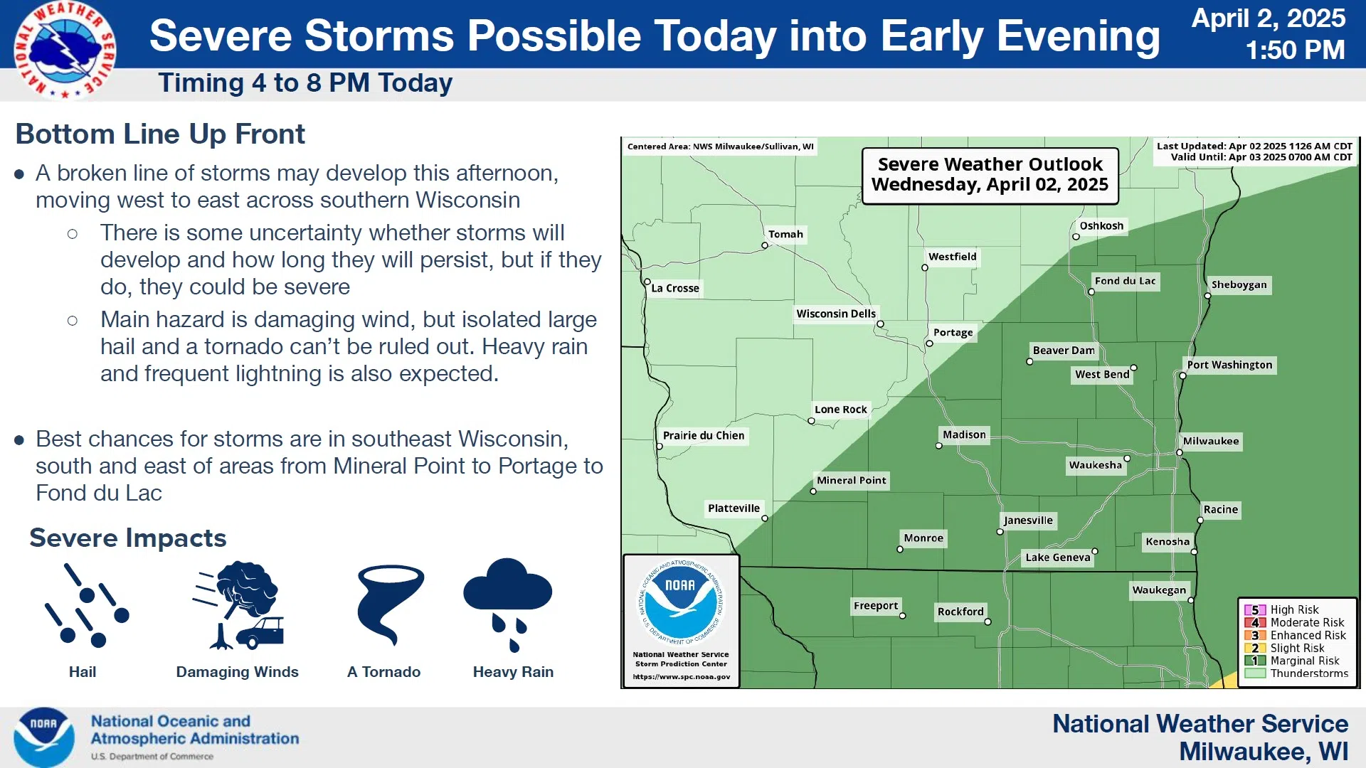
The risk of severe thunderstorms has relaxed for the Sheboygan area this afternoon and evening, however forecasters aren’t necessarily giving the “all clear”.
Rain and clouds this morning lingered longer than expected, meaning less energy for severe thunderstorms to feed upon. There will still be enough dynamics remaining for attention, mostly for hazards presented by damaging winds, with the greatest likelihood south and east of areas from Minderal Point to Portage to Fond du Lac.
NWS Graphic
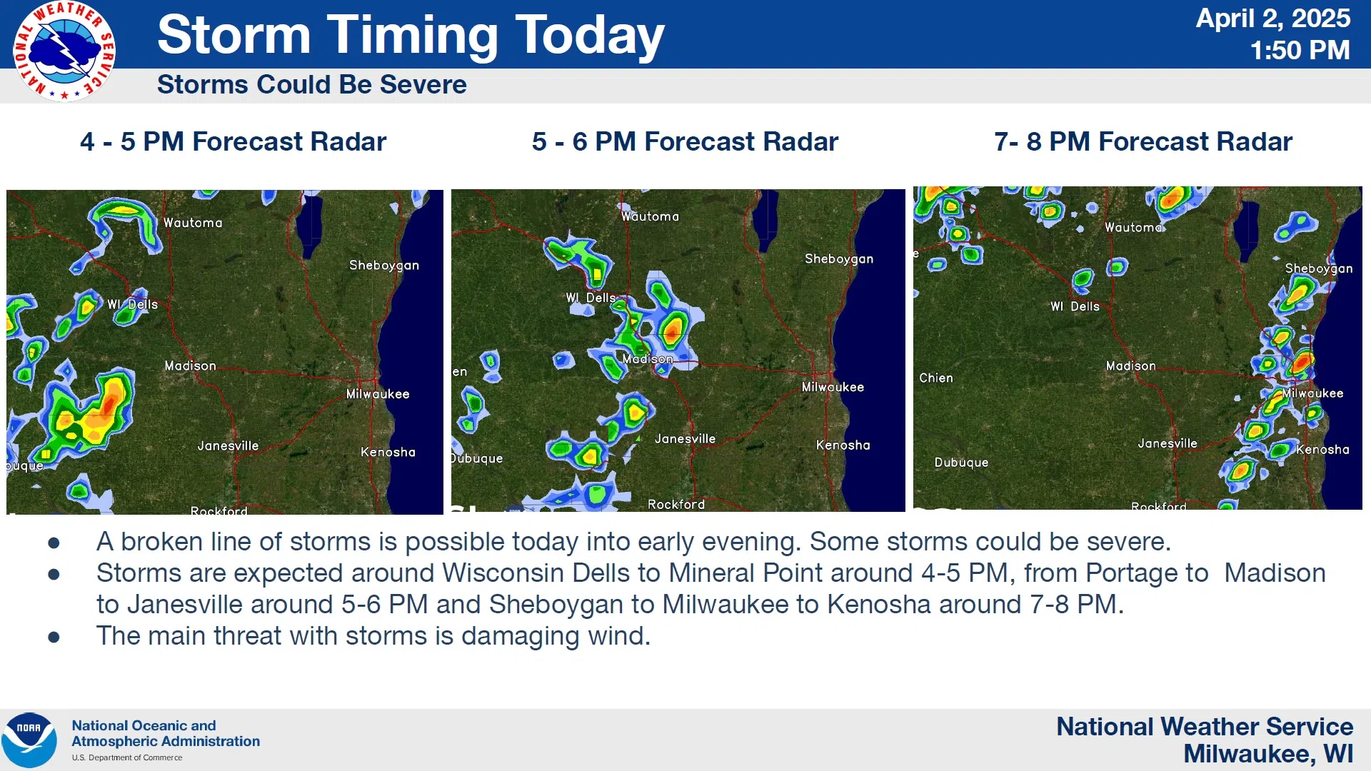
If storms do develop as projected, they would arrive between 7 and 8 p.m., and exit within an hour or two. In their wake, breezy westerly winds will usher in drier air for Thursday under partly sunny skies, with highs in the mid 40s and wind chills in the mid 30s.


Comments