April Wisconsin weather isn’t for the faint of heart, as evidenced in a forecast replete with wintry snow showers and springlike thunderstorms.
The snow part might escape the notice of many, as the flakes fell mostly in the dark of the night and didn’t accumulate. Thunderstorms will be harder to ignore, as two rounds are forecast to move through, one this morning, and another this afternoon.
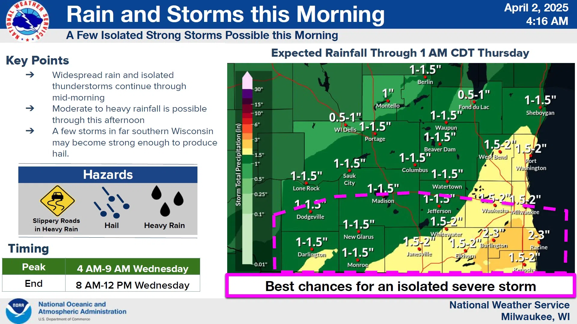
While the morning round shouldn’t be severe, rainfall rates of up to an inch per hour are possible up until 2 p.m., with totals of 1-3 inches threatening areas of standing water. Hydrologists were confident that generally low river levels should help avoid flooding except for small creeks and streams.

NWS Graphic
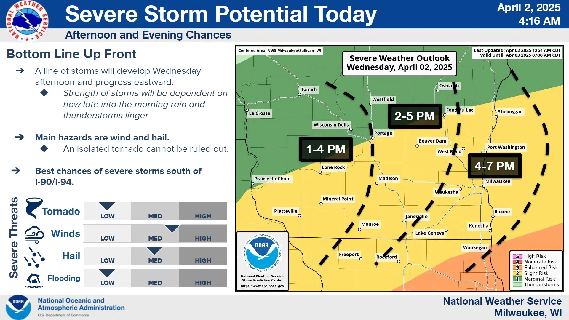
Severe weather is most likely between 1 and 7 p.m., with counties along and south of the I-90/94 corridor most likely to see some damaging winds and large hail. But even absent of thunderstorms, winds in Sheboygan County are forecast to be sustained at 20-25 mph with gusts to 40 this afternoon.
Once the system moves through, generally quiet, seasonable weather should rule the rest of the week, but snow showers do sneak back into the forecast by Monday.


Comments