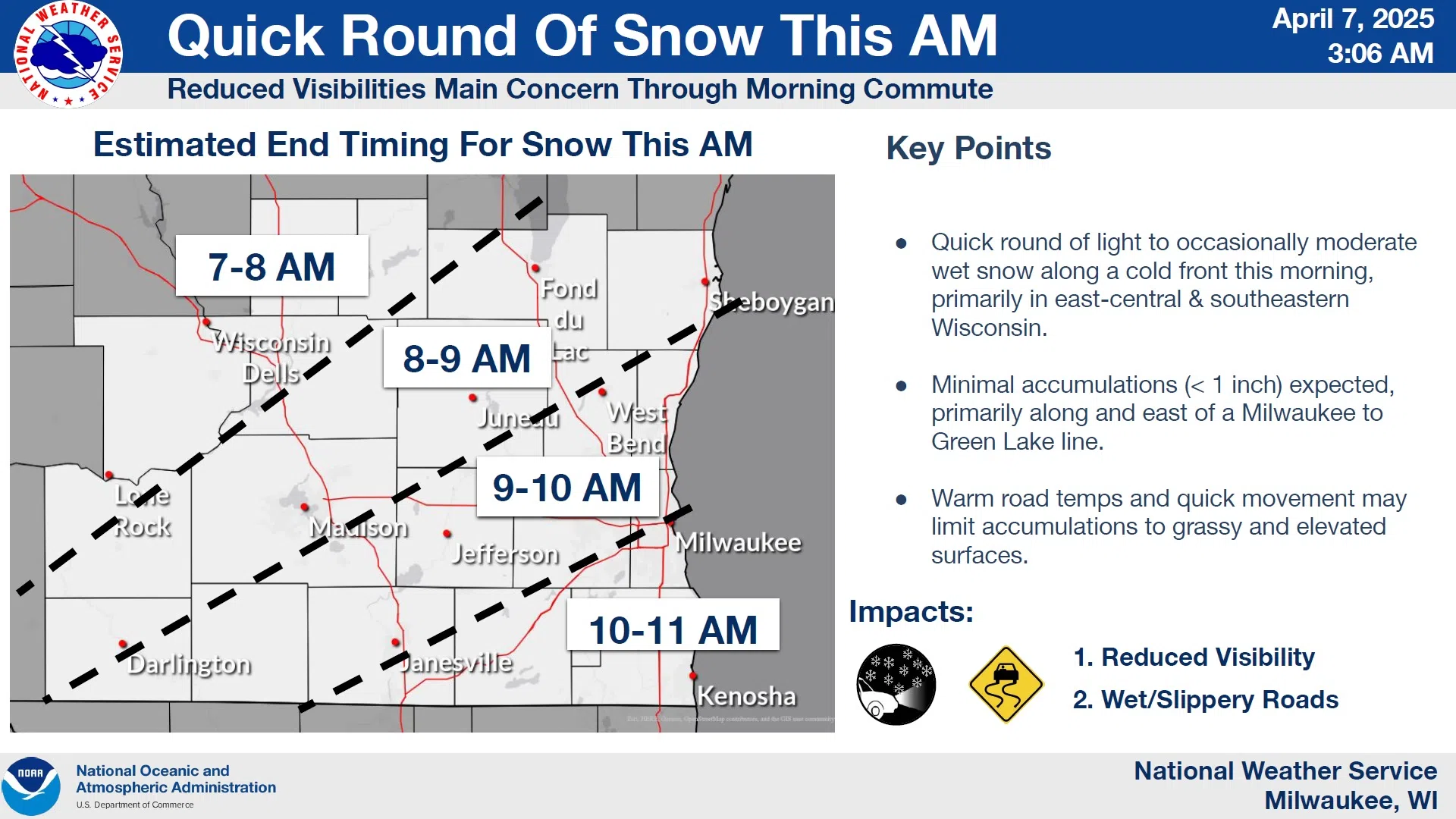
Light snow that was forecast to have fallen overnight has slowed its approach. That change in pace means that any snow that does fall will, unfortunately, occur during the busy morning hours as it moves in from the north.
Snow will initially be slushy and wet, but gradually transition to a drier and more powdery character, and with rates up to a half inch per hour, minor accumulations might collect on grassy surfaces faster than temperatures can melt it. It’s also possible that wet roads and reduced visibility could affect travel, especially if additional moisture is drawn into the system, but there’s plenty of uncertainty as to that scenario.
NWS Graphic
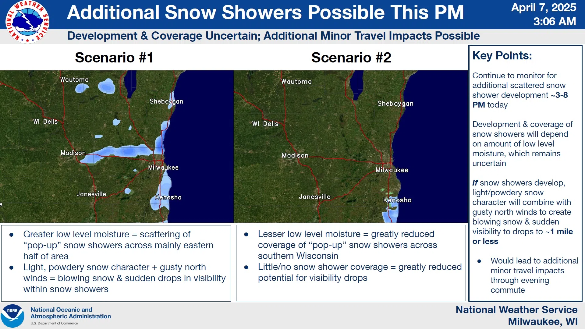
Snow showers could linger and even pick up again this afternoon as gusty northerly winds drive cold air across the region. Temperatures are likely to drop into the lower 20s tonight, some 10 degrees lower than normal, and despite sunshine on Tuesday, highs aren’t expected to exceed the mid 30s, with 40s expected for highs the remainder of the week.


Comments