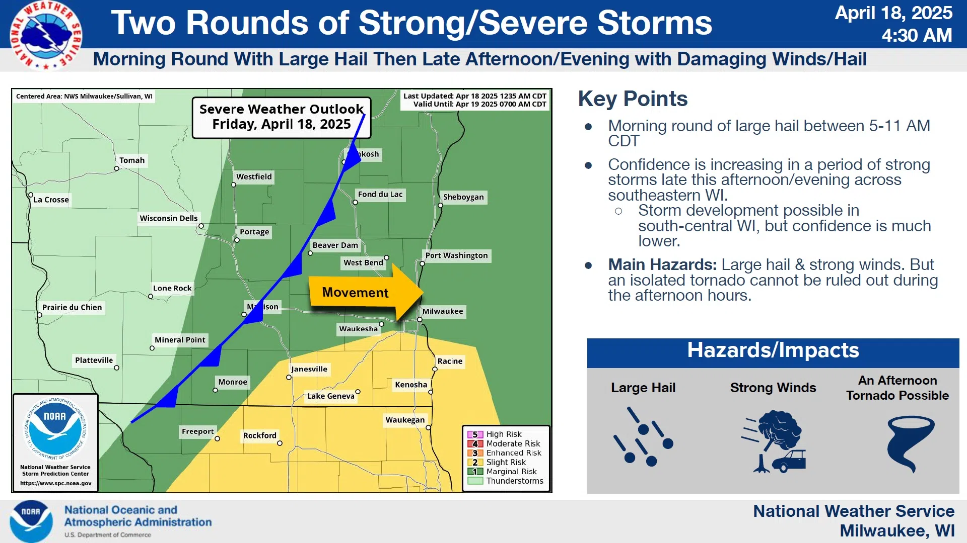
Two rounds of thunderstorms will be closely monitored for severe activity by the National Weather Service today. And although the greater risk exists southeast of a Milwaukee to Monroe line, the Sheboygan Area remains in a “marginal” risk zone for storms that could contain large hail and strong winds. Although the risk is slight, an isolated tornado can’t be ruled out this afternoon, but first-up is a morning round moving out of Iowa that has a history of golfball size hail. The odds of maintaining that strength by the time it arrives here between 7 and 9 a.m. are small, but worth monitoring.
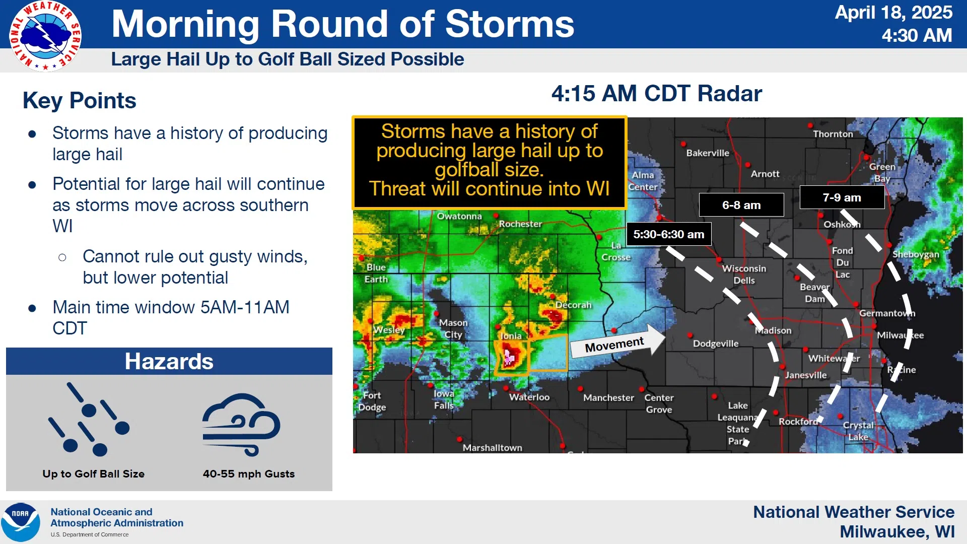
NWS Graphic
This afternoon will likely provide more potential for damaging winds and hail as a cold front plows through, generating several rounds of storms in central Wisconsin that will impact our area mostly between 6 and 11 p.m. as they progress southeast.
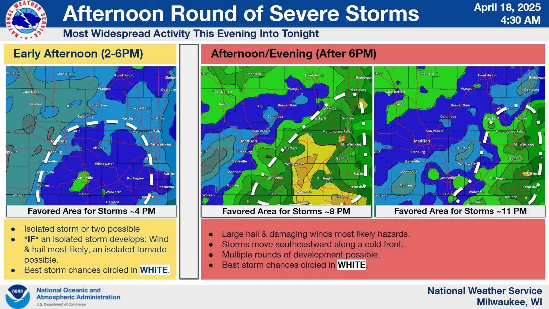
NWS Graphic
As conditions can change quickly, people should stay alert for possible watches or warnings later today.


Comments