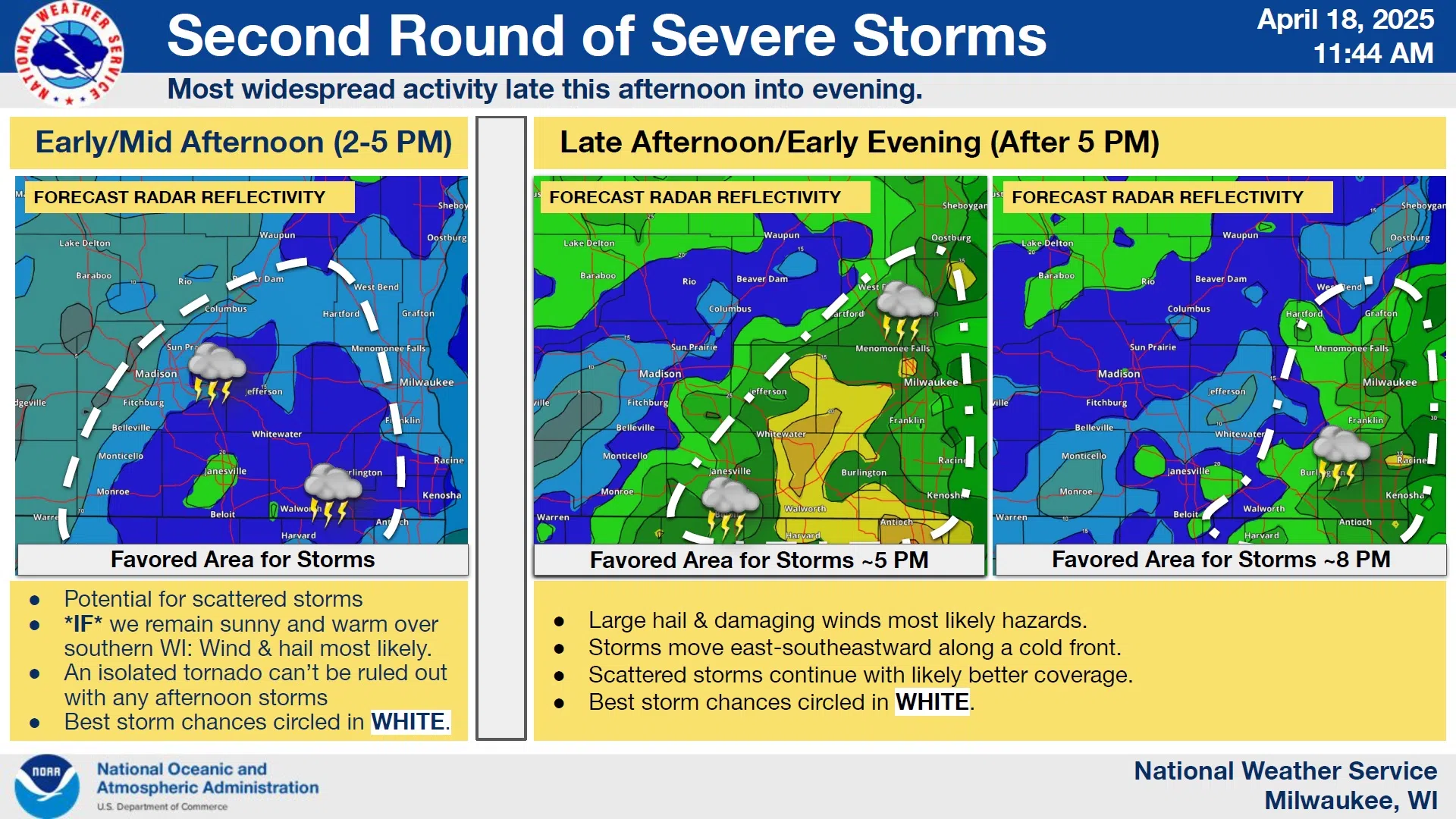
After a morning round of storms behaved as expected, forecasters with the National Weather Service have settled their expectations for the Friday afternoon and evening hours.
The window of opportunity for the strongest storms was affirmed to line up with the late afternoon and evening period, but the severe potential largely depended upon afternoon clearing – which did not materialize – and has served to limit overall likelihood of large hail and strong winds – the principal threat.
Still, projections for storms to develop between Madison and Lone Rock in the early afternoon hours have materialized, and so southeastern Wisconsin remains on alert for thunderstorms that could reach severe limits, mostly to the south of the Sheboygan area.
After rains abate overnight, sunshine should eventually take hold on Saturday with highs reaching the low 50s. Easter Sunday is forecast to dawn with partly cloudy skies and temperatures in the mid 40s where they’re forecast to linger most of the day.


Comments