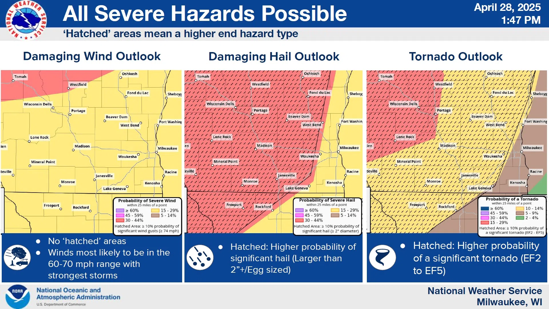
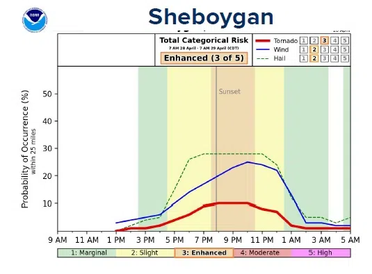
The question among forecasters at the National Weather Service isn’t so much on whether or not severe weather will happen tonight, but rather where it would occur if it does develop. And although the risks may be less here than to our west, the National Weather Service is not dismissing the chance for high winds, large hail, and possible F2 tornadoes that could affect the Sheboygan area.
NWS Graphic
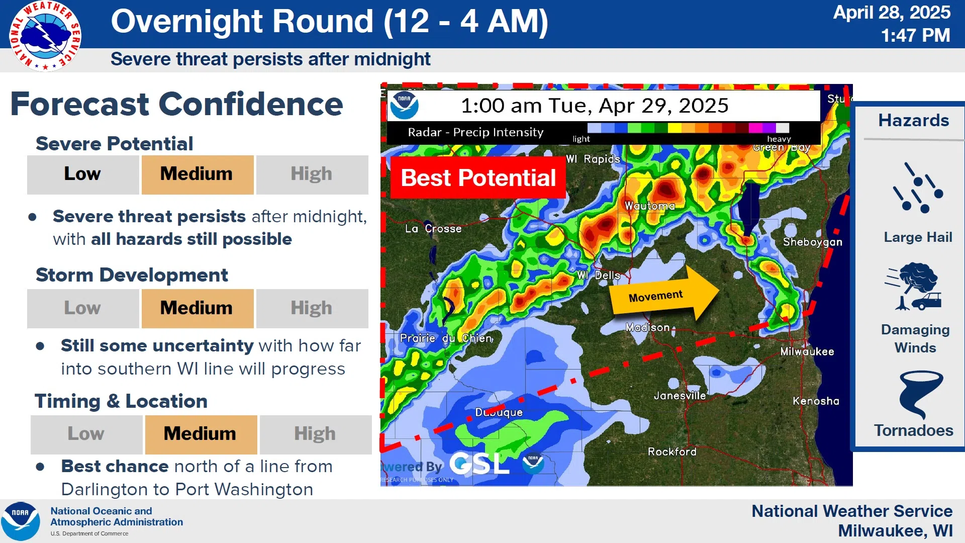
An initial round of thunderstorms moving through Wisconsin from west to east is affecting areas mostly west of the Wisconsin River, but this is expected to move into northeast Wisconsin by the evening hours. Of greater concern is an overnight batch developing to our southwest that has an even better potential than during the afternoon, presenting a worrisome nighttime severe event that may catch much of the public asleep when it arrives.
NWS Graphic
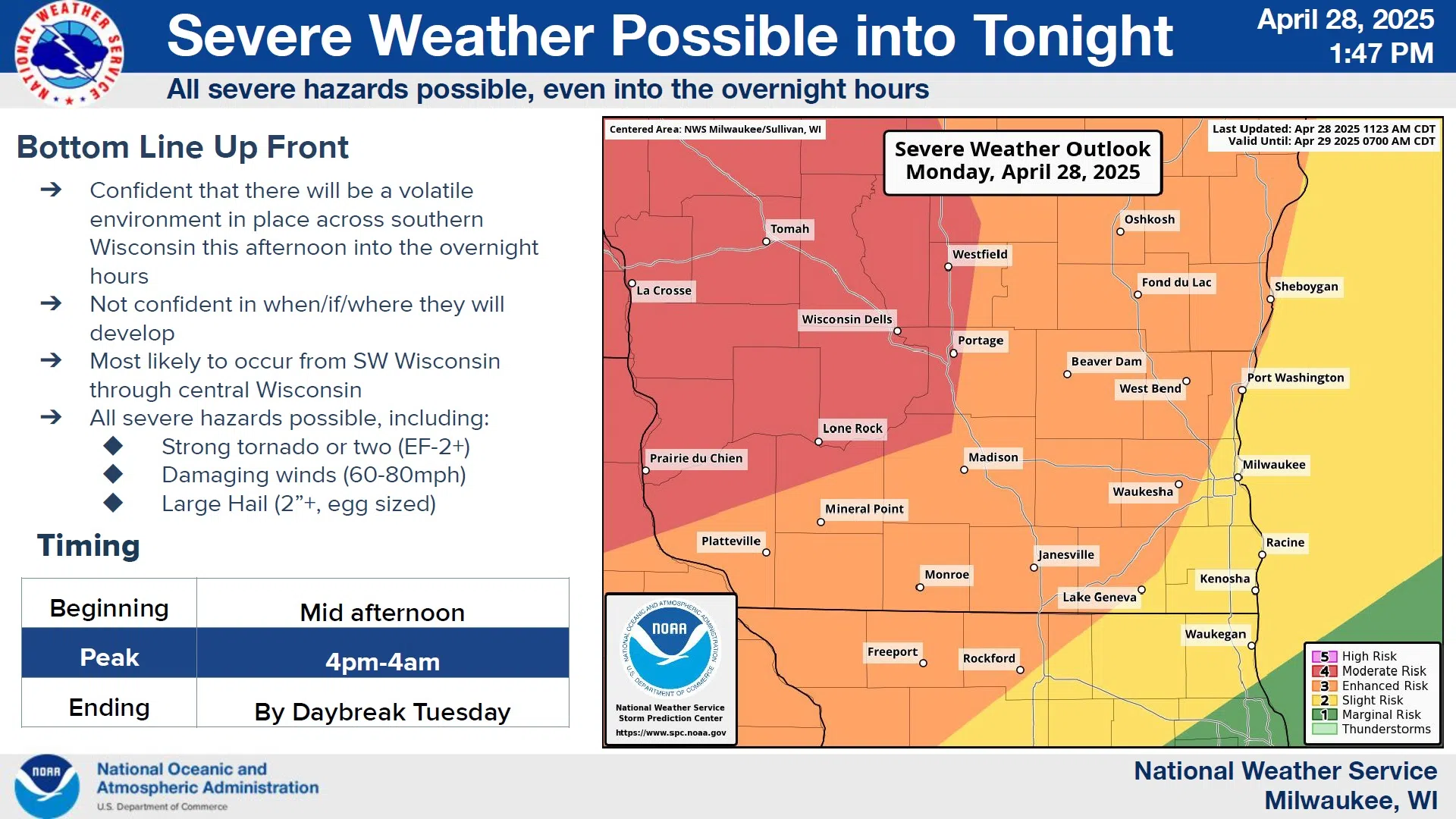
After a potential round of late afternoon and early evening storms, attention will focus on the period between midnight and 4 a.m. on Tuesday, when the highest risk of severe weather will be present. There are some concerns about development just southwest of Sheboygan County that have prompted speculation that the area will “pop” with development around 1 a.m.
NWS Graphic
The National Weather Service is advising that someone in the household be capable of receiving alerts should they be necessary in order to take action if severe weather approaches.


Comments