
A weather situation that first drew the attention of forecasters and public protection agencies last week is now knocking on our door, with severe weather potential top-of-mind.
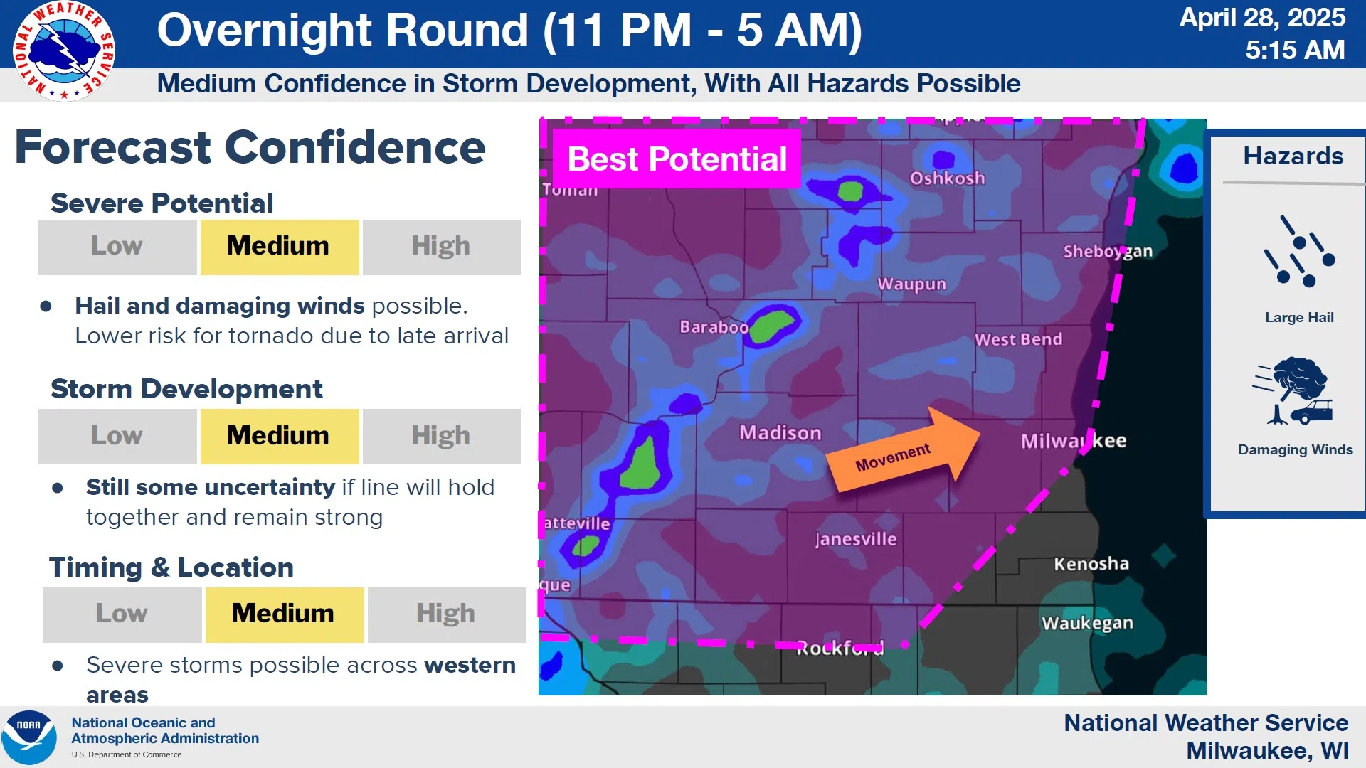
For the Sheboygan area, it may be a matter of fortune that we’re removed from the area of greatest concern, but not by much. And with the greatest threat coming from overnight storms into early Tuesday morning, the public is being advised to keep some way of receiving alerts close by when you go to sleep.
NWS Graphic
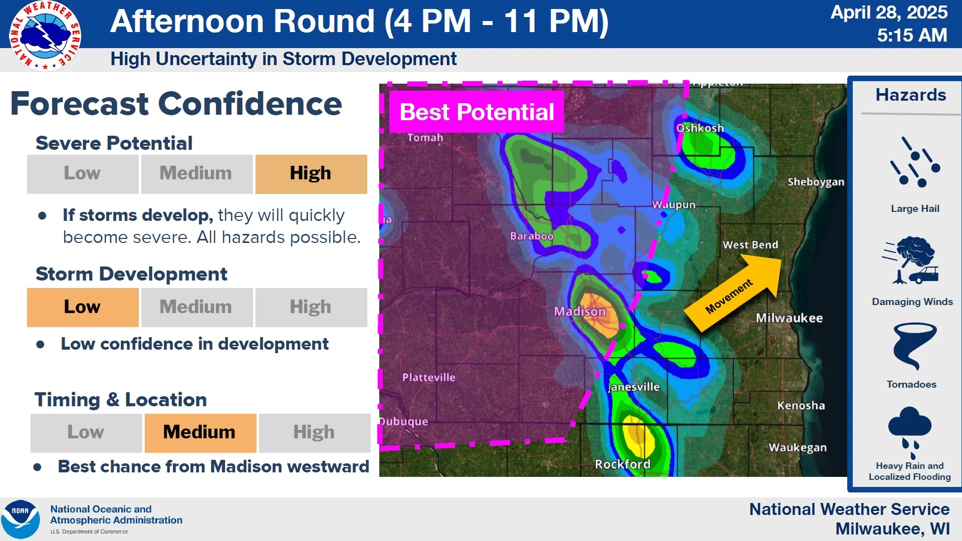
An initial round of storms had yet to develop early this morning, relieving some of the concerns of forecasters, but the ingredients for two additional rounds remains beginning around 4 this afternoon when isolated to scattered storms begin to develop. While those could produce severe weather as they move northeast, the greater threat begins after 6 to our southwest, providing an hours-early look at what we could experience later on. That’s when storms will threaten south-central Wisconsin with large hail and damaging winds, although tornados can’t be ruled out there.
NWS Graphic
While forecasters say that the strongest storms probably won’t maintain severe strength by the time they’d reach us…sometime after midnight…it could take until 7 or 8 a.m. before we’re completely free of concern.


Comments