National Weather Service Meteorologists are gaining a better handle on the nature of Thursday’s threat of severe weather in Wisconsin. While far southern Wisconsin’s vulnerability remains a question, the confidence that severe weather happens somewhere in the region has increased, and that includes Sheboygan County.
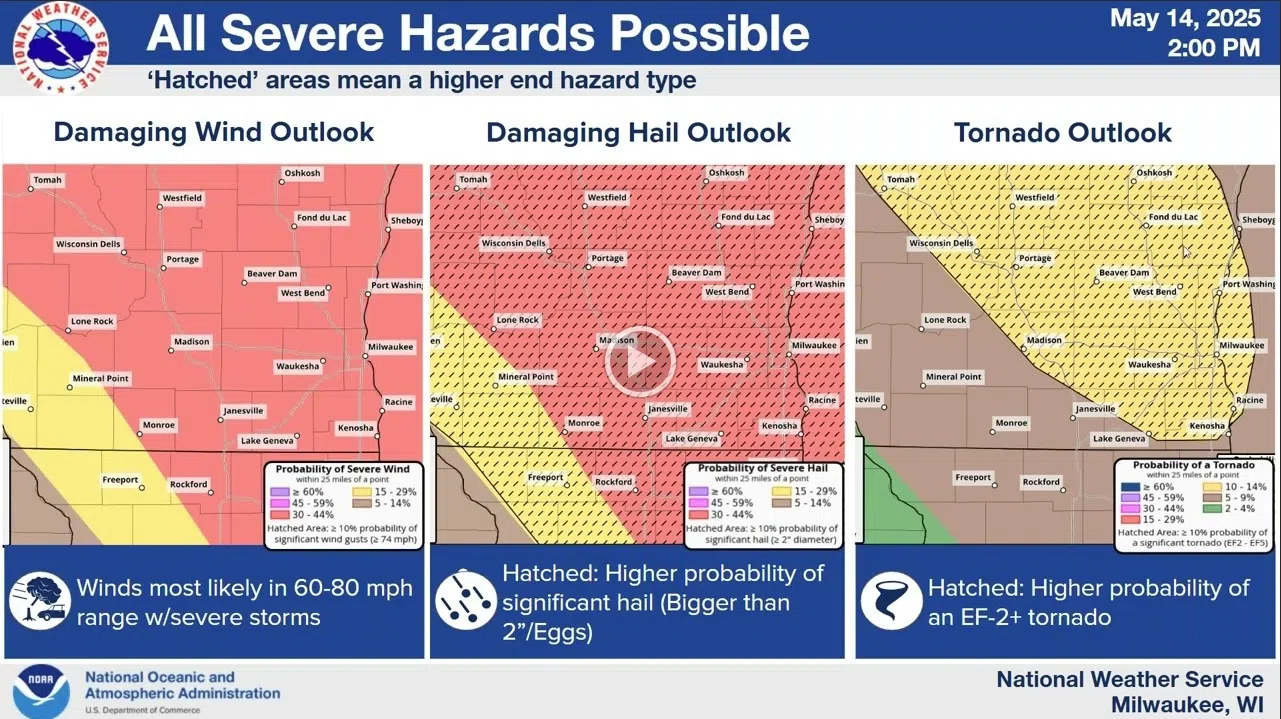
In detailing their latest analysis, forecasters say that the overall potential for storms has increased, with all but the extreme northwestern and southwestern counties in a 3-in-5 “enhanced” risk of storms that could produce heavy rain, large hail, high winds and possible tornadoes. Broken down by specific threats for Sheboygan County, the danger of both damaging winds as well large hail are assigned a 30-44% likelihood, while the threat of an EF2+ tornado has been assigned a 10-14% risk of occurrence. That being said, the risk of tornadoes is lessened by the cooler air present in areas near Lake Michigan such as Sheboygan and other lakeshore counties.
NWS Graphic
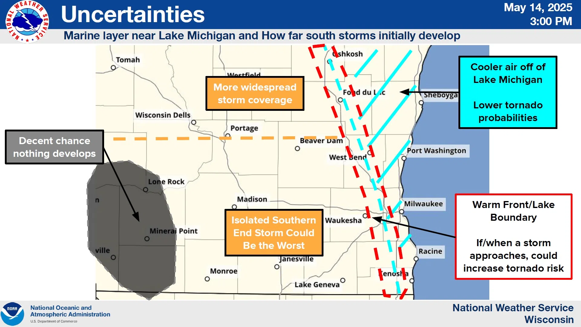
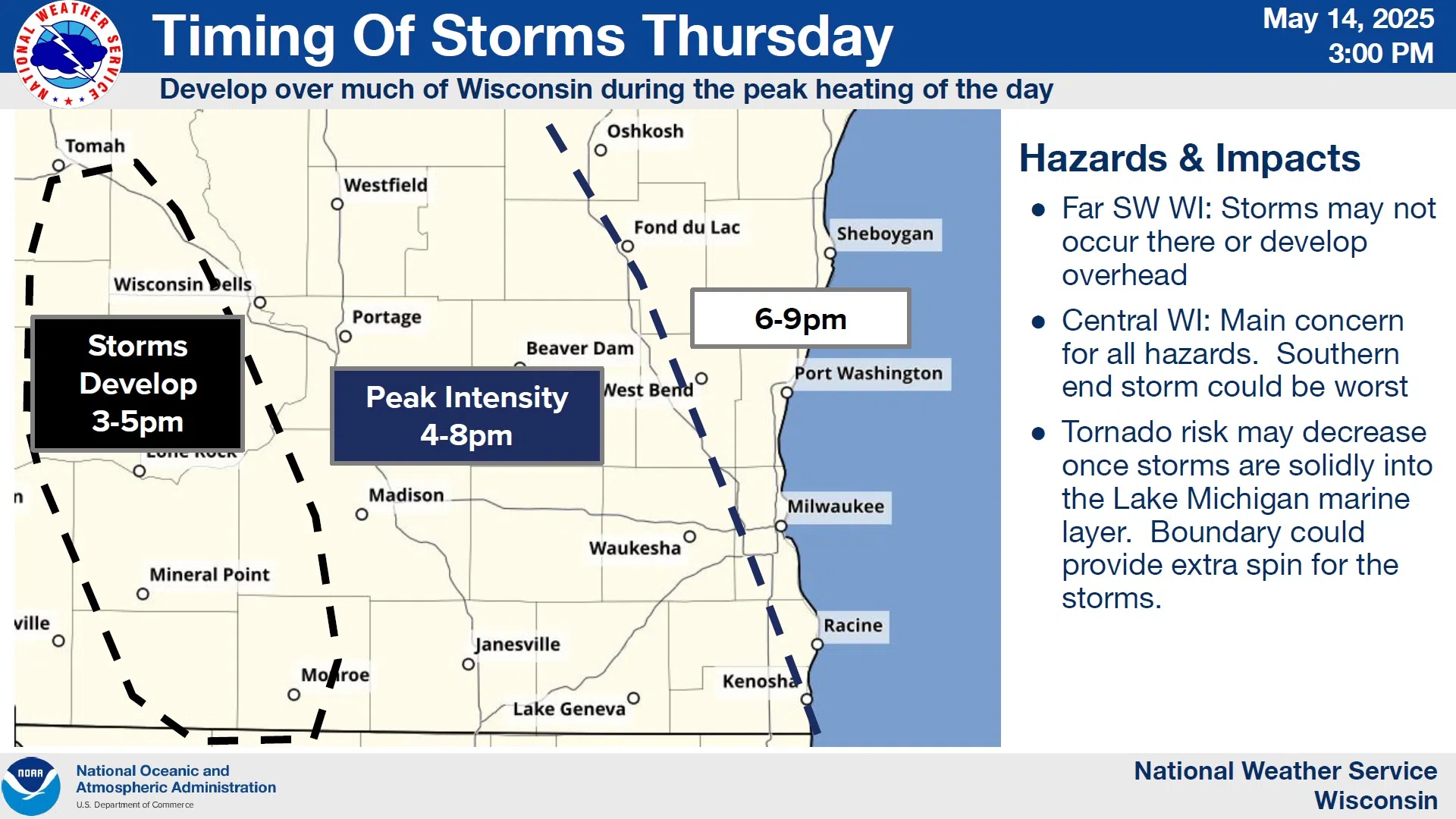
Hail larger than egg-sized now looks “very likely” in the words of forecasters, but with the fast movement of the system, flooding rains are not considered a threat. Timing also works in the favor of lakeshore counties as the hours of peak intensity, between 4 and 8 p.m., precede the most likely timing of our storms, which falls between 6 and 9 p.m., also lessening the threat of tornado activity. The influence of Lake Michigan could, however, be a mixed blessing as the boundary between the warm and cold air masses west of the Kettle Moraine could intensify development.
NWS Graphic
Storms are now expected to progress over the shoreline between 8 and 9 p.m. on Thursday, slightly sooner than originally expected. Such dynamics can mean rapid changes to the forecasts, and so the National Weather Service is urging the public to stay abreast of late developments.


Comments