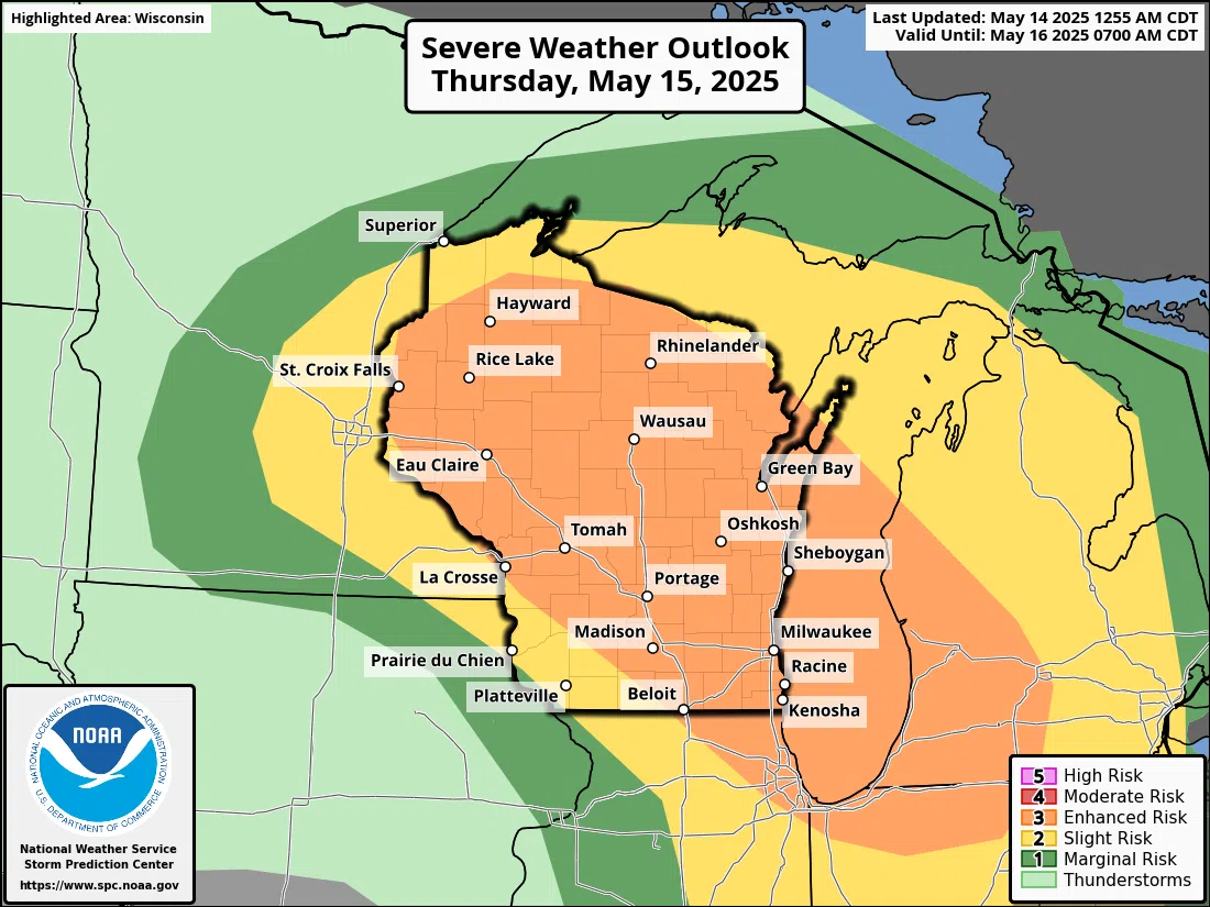
National Weather Service forecasters are now zeroing in on those areas most likely to experience damaging thunderstorms on Thursday. While acknowledging that the overall potential for severe weather in Wisconsin tomorrow hasn’t changed much since being assessed on Tuesday afternoon, many questions remain on the eventual threat level in and around Sheboygan County.
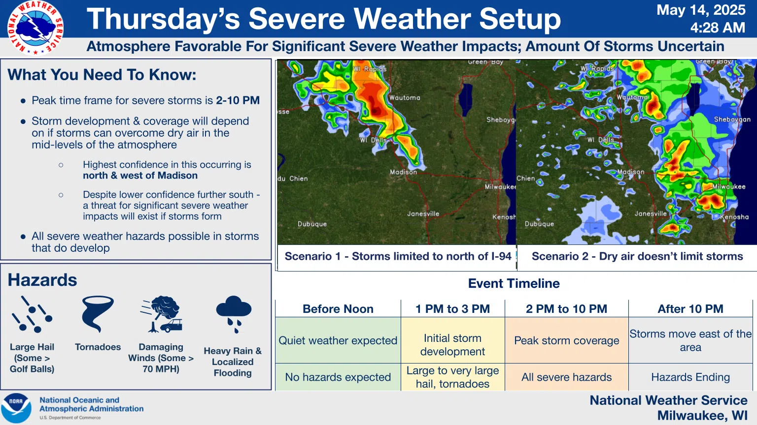
The thought now is that a batch of drier air could suppress strong thunderstorm development in the far south, while closer attention will be needed north and west of Madison. That leaves a bit more uncertainty in east-central Wisconsin, but with west-to-east storm movement expected, we should have a better idea based upon what those areas upstream of us experience. Storms there should develop between 1 and 3 p.m., putting us in the target zone between 4 and 10 p.m.
NWS Graphic
Most of Wisconsin has an enhanced, level three of five risk of experiencing heavy rain, hail larger than golf balls, winds exceeding 70 mph, and possible tornadoes. A reassessment this afternoon should provide better focus of what’s to come.


Comments