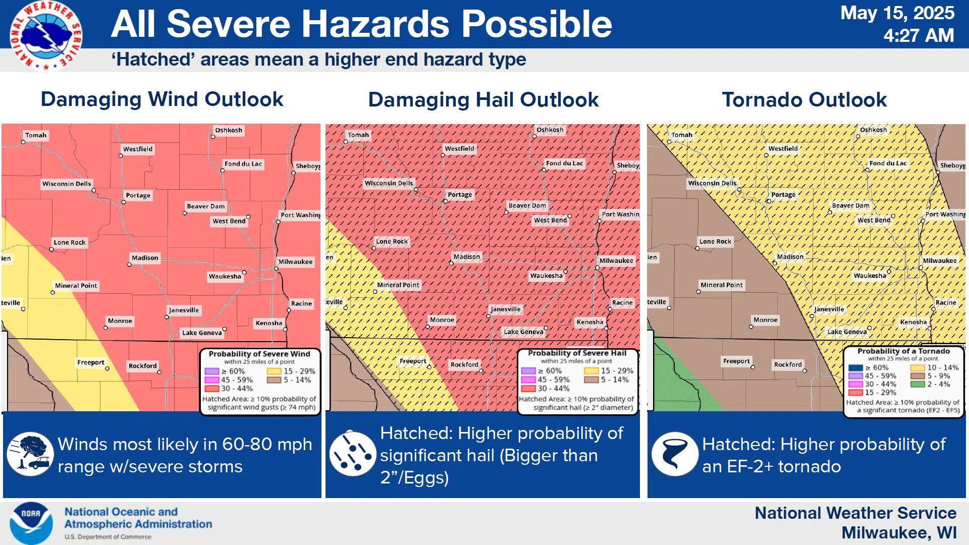
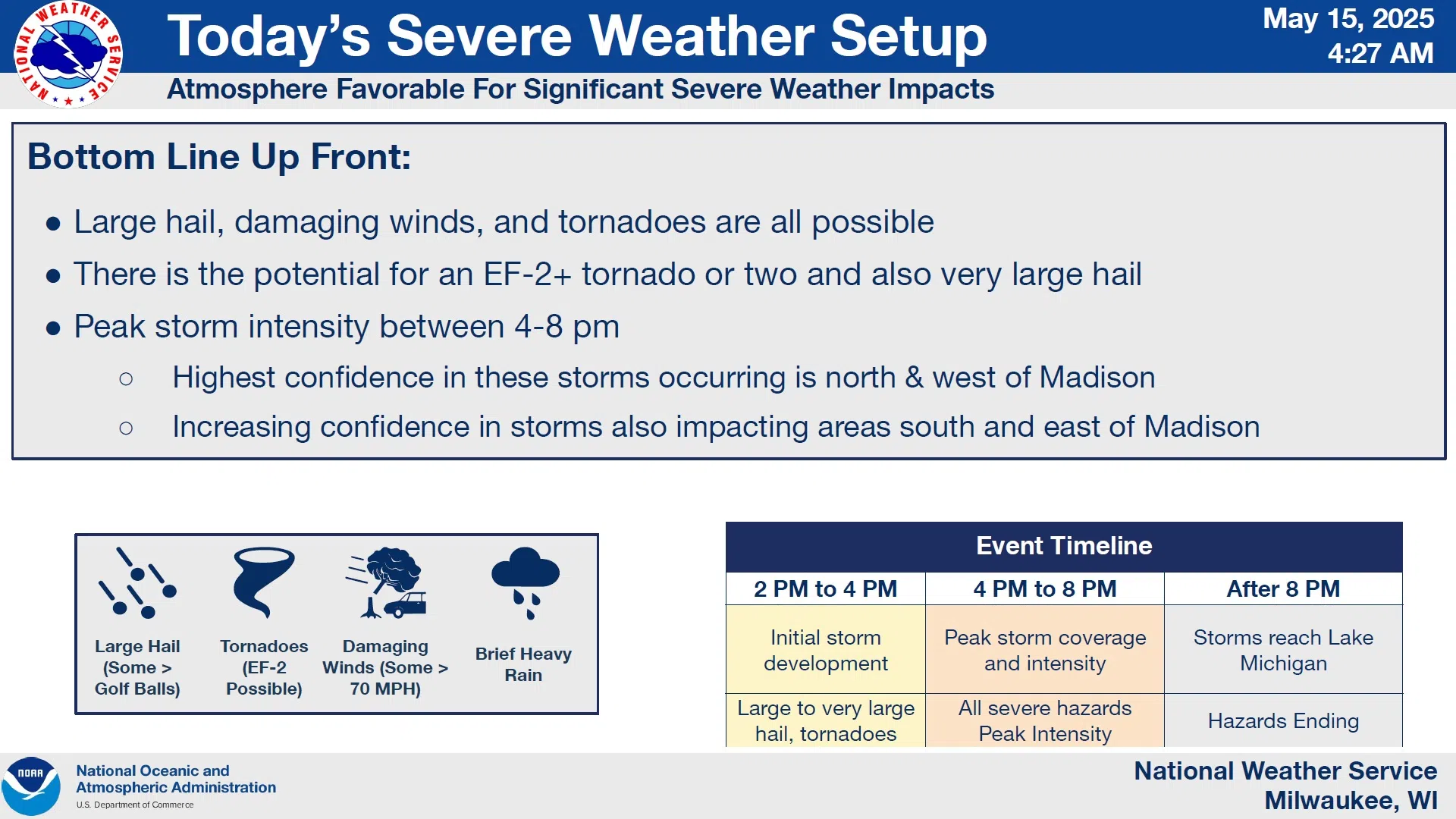
 Forecasters have been anticipating today’s severe weather outbreak since this past Sunday, and it appears for good reason. The risks involve those of hail the size of eggs or larger, hurricane-force winds, and tornadoes of F2 strength or greater.
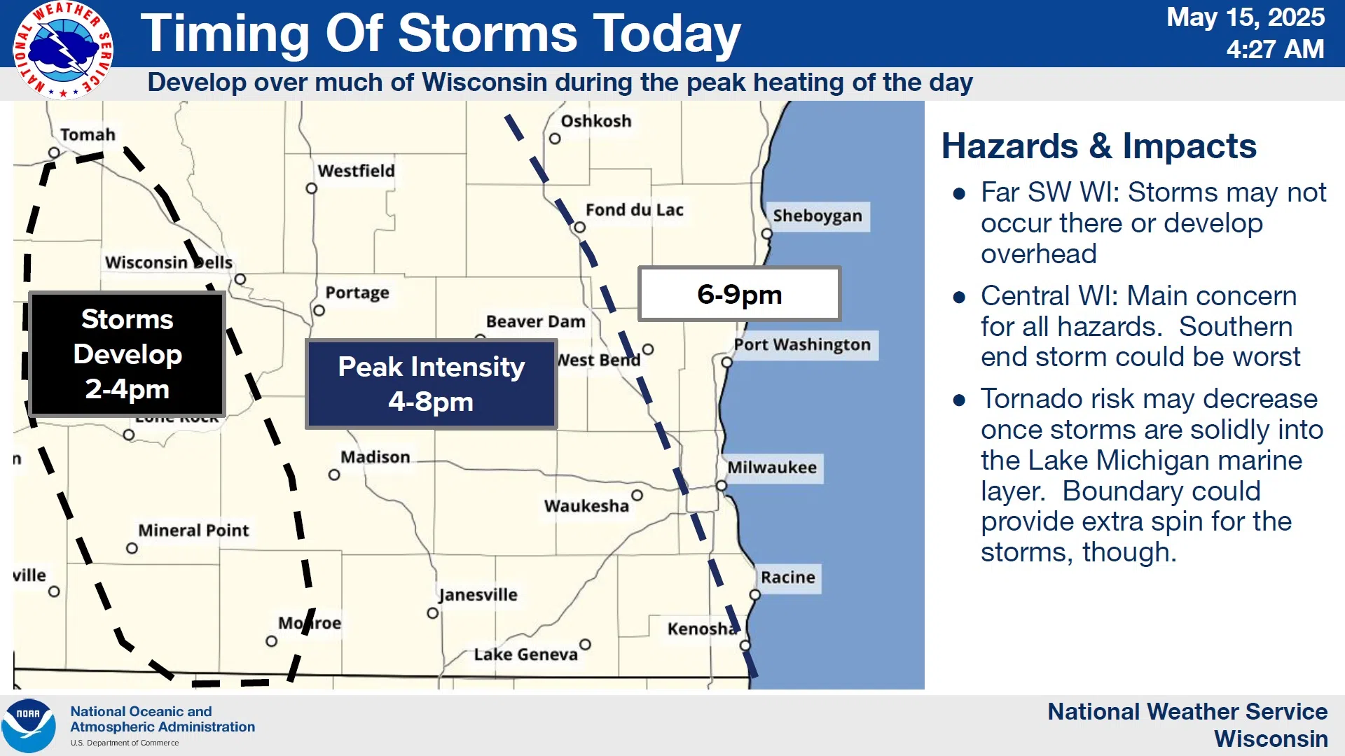
Storm should begin developing between 2 and 4 p.m. today in central Wisconsin, and reach peak intensity and coverage between 4 and 8 p.m., after which they should exit over Lake Michigan.
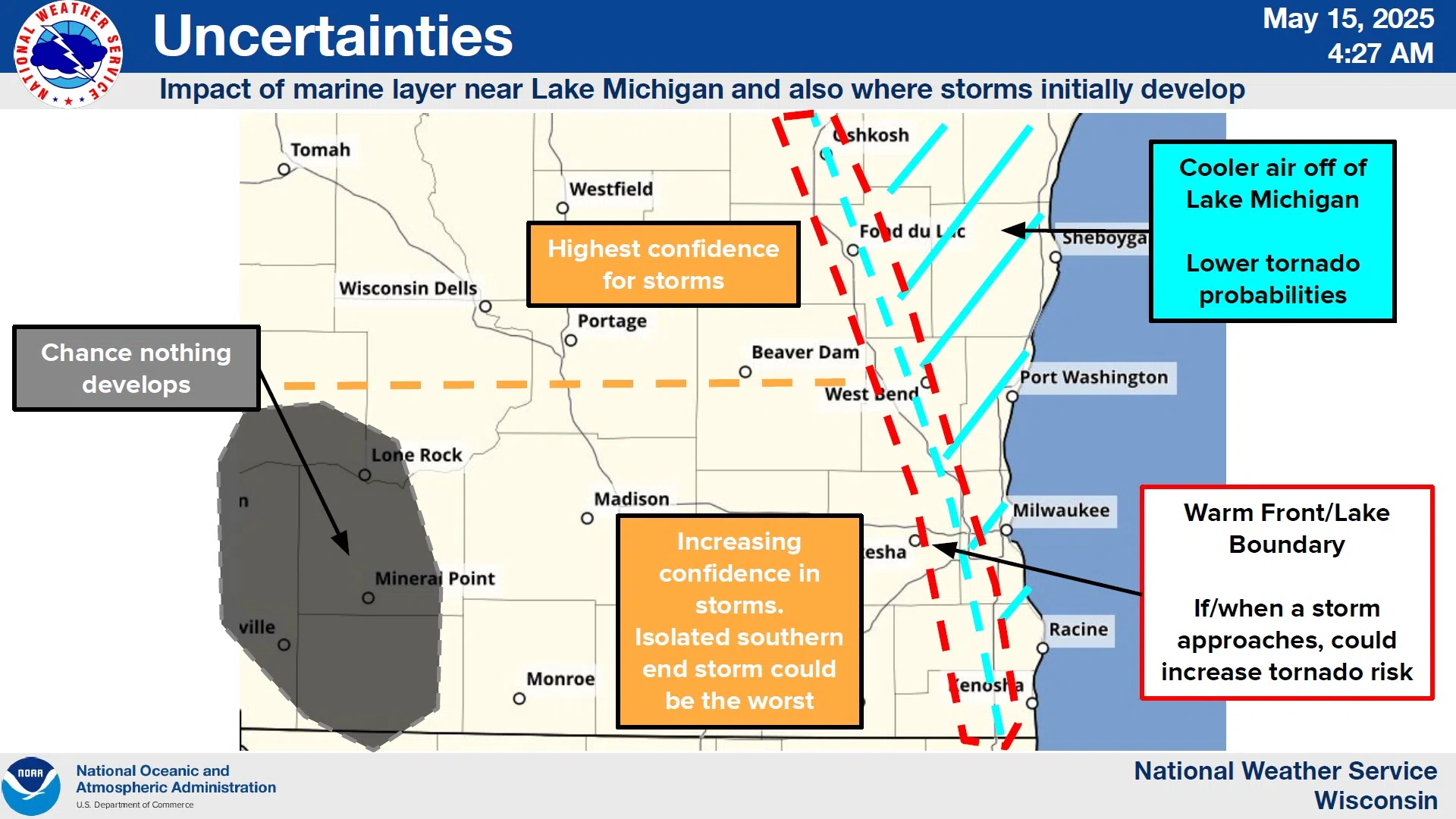
 Current indications suggest that the Sheboygan County area has a 30-44% likelihood of both the large hail and winds between 60 and 80 mph, while the tornado risk is a little less and harder to nail down. A 10-14% probability is given overall, however cooler air off Lake Michigan complicates the picture as it could suppress tornado formation east of an Oshkosh to Kenosha line, while also intensifying storms along the boundary between the cool air here and very warm, moist air to the west.
 Forecasters will be reassessing the scenario later this morning, and they advise everybody to keep up with developments.


Comments