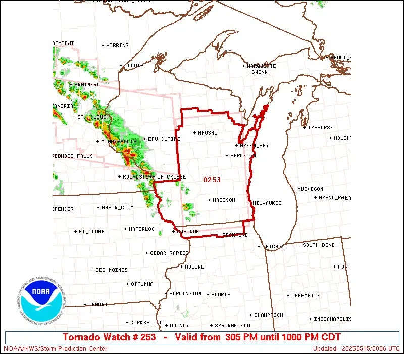
The Severe Storms Prediction Center in Kansas City has issued a Tornado Watch for portions of Wisconsin that include the Sheboygan area.
Expectations that storms would begin in southwestern and south-central Wisconsin were validated by 3 p.m. even as areas in Minnesota were already issued tornado warnings associated with the same, energetic weather system concerning our area.
The Tornado Watch went into effect at 3:05 p.m. and will remain so until 10 p.m. for a large portion of Wisconsin and extreme northern Illinois. Besides the need to be aware of possible EF-2+ tornadoes, initial expectations of damaging wind and hail remain unchanged. What has changed is an increase in expected storm coverage in southeastern Wisconsin which includes those damaging winds. Additionally, the so-called “marine layer” of colder Lake Michigan air with the potential to suppress severe activity has lessened, exposing areas such as ours to increasing risks.
The predicted timing of the storms’ passages remains intact, with the peak activity expected to occur between 4 and 8 p.m.
By 1:45 this afternoon, the first significant thunderstorm cells had emerged near Dodgevillle and were progressing northeastward. By 6-9 p.m., the expected line of storms should extend all the way along the Lake Michigan shoreline with an increased possibility of damaging winds, brief tornadoes, and hail the size of eggs or larger as they move through.
The National Weather Service is urging the public to activate notifications on their mobile devices, and emphasized that warnings will only sound if: a tornado of any strength is imminent or, a severe thunderstorm capable of 80 mph winds or baseball size hail is approaching.
WHBL News will remain on alert and is ready to go full-time coverage should conditions warrant.


Comments