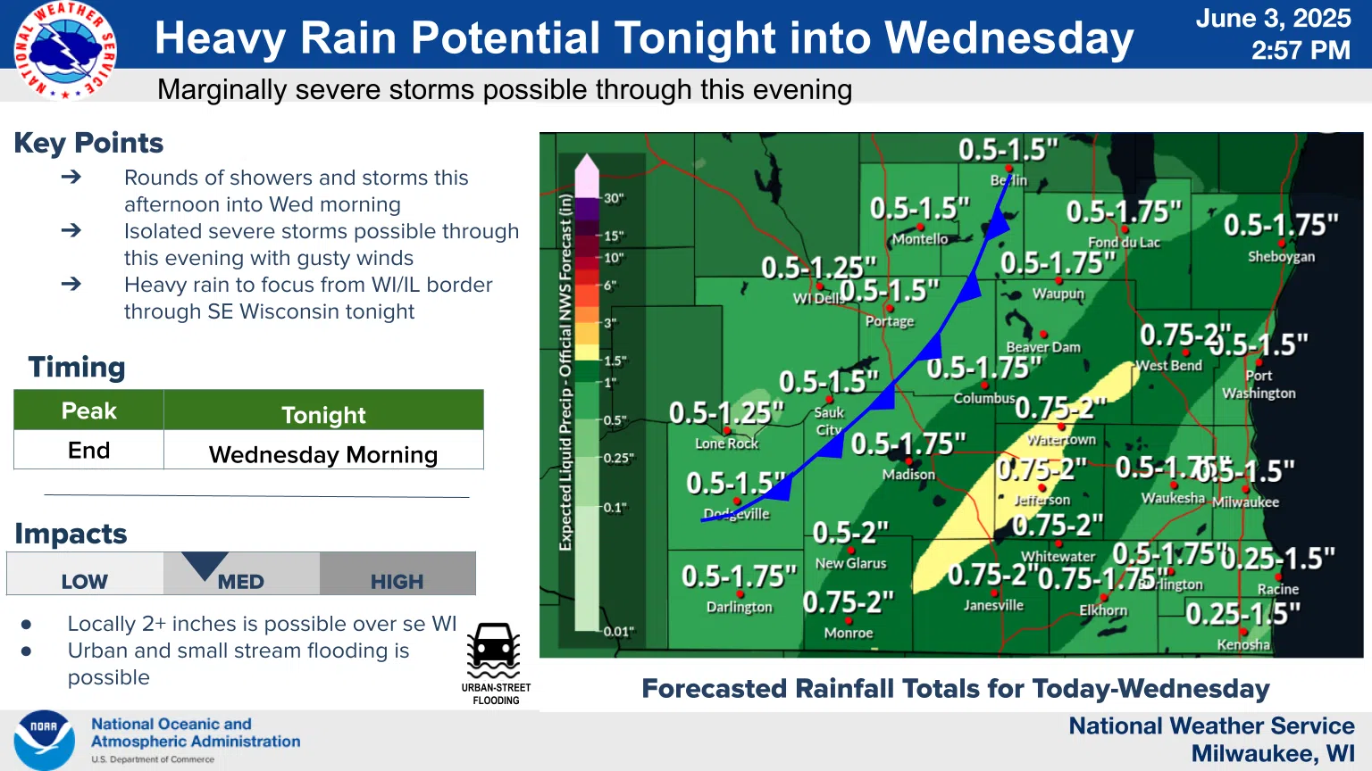
The attention of National Weather Service meteorologists was briefly diverted to an outbreak of thunderstorm downburst winds capable of blowing down trees among other damage, but after an early afternoon round of activity, it appears that heavy rainfall remains the most likely drawback from afternoon thunderstorms moving through the area.
Nailing down the exact areas that might experience “training” thunderstorms – a succession of storm cells over the same area for an extended period of time – is inexact, but the possibility exists for total rains in excess of two inches now through Wednesday morning in most of our area. If flooding does occur, the most likely effects will be felt as urban (roadway) and small stream flooding.
Even as rain sometimes cleans the air of pollutants, that’s not expected to be enough to avoid trouble from Canadian wildfires, and an Air Quality Alert was issued for not only Sheboygan County, but for all of Wisconsin and Iowa, and most of Minnesota, the UP of Michigan and extending to eastern Nebraska. That’s due largely to the smoke from wildfires occurring in Canada.
Smoke particles, classified by the EPA as PM2.5, are expected to reach unhealthy levels from now until noon on Wednesday. Those with asthma, heart disease, or other compromising conditions, should avoid outdoor activities and keep emergency meds on-hand.
The National Weather Service said that smoke is dense at the surface in the wake of an advancing cold front, and most of the state will experience at least some of the associated effects. The smoke was expected to reach a Janesville – to – Sheboygan line by around 12 midnight on Tuesday, eventually reaching Kenosha by 6 a.m. Wednesday.


Comments