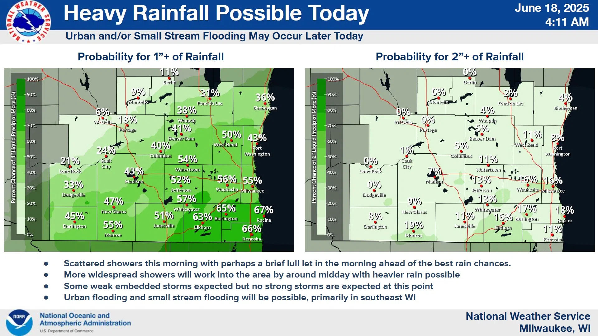
The National Weather Service is keeping a close eye on the potential for heavy rainfall in Wisconsin today, including the Sheboygan area. The day began before dawn with a few light showers, but those were just a preview of a more substantial batch expected to affect mostly the mid-late afternoon hours. Although thunderstorms are possible today, severe weather isn’t expected, but the estimated 2/3 to 3/4 inches of rain that falls could cause some urban and small stream flooding especially if storms do strengthen.
The approaching low pressure behind the rainfall did sink a bit further south than predicted yesterday, and that should keep the heaviest rain potential also to our south.


Comments