After three days of hot, muggy weather, Wisconsin and the Sheboygan area are in for some cooler, albeit wetter weather – eventually.
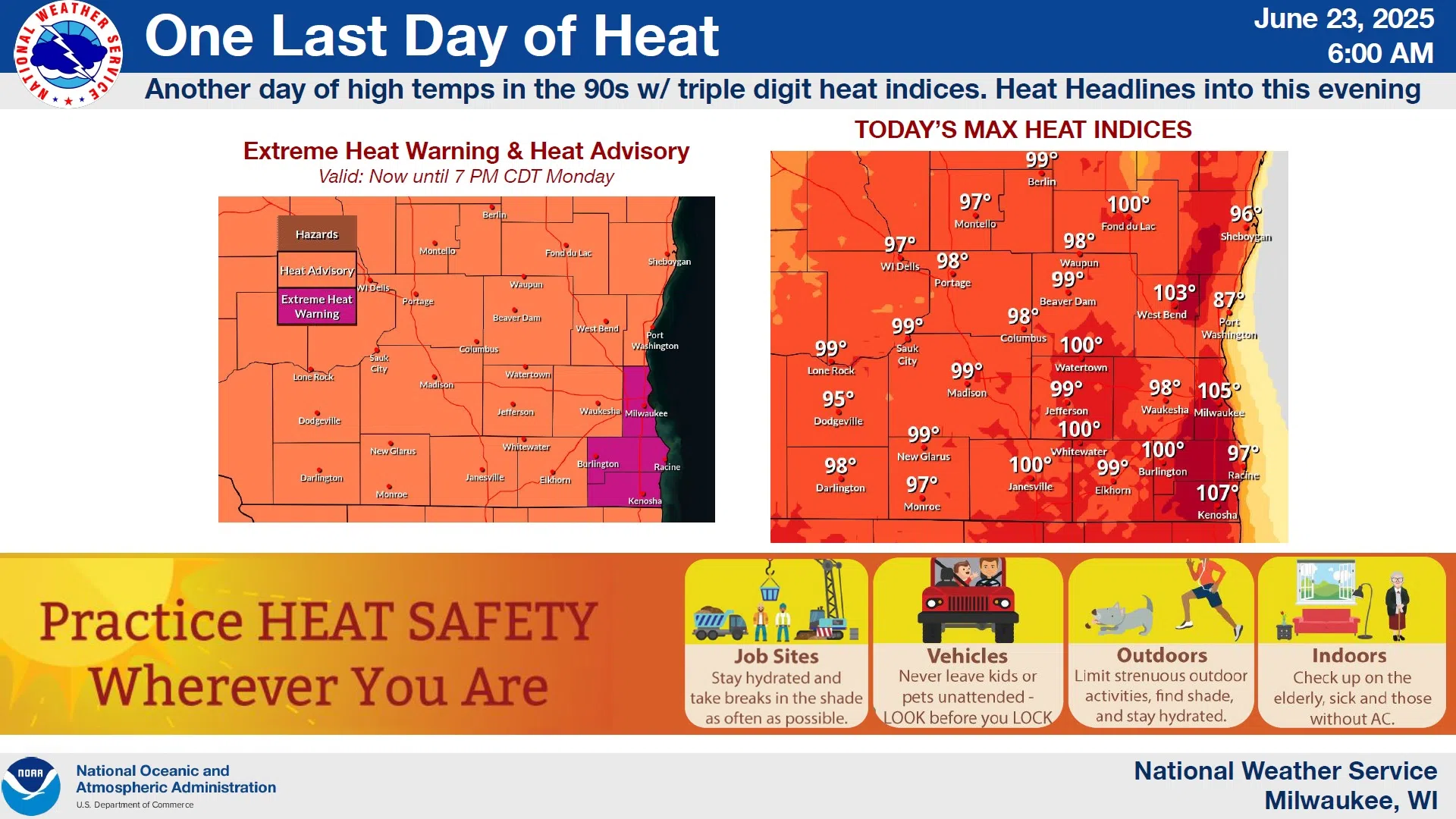
As was the case over the weekend, heat index readings today will be pushed well into the 90s in the Sheboygan area where a Heat Advisory is in effect until 7 PM. The worst of the hot conditions will be in Milwaukee, Racine and Kenosha Counties where triple-digit heat index readings have maintained an Extreme Heat Warning. Weekend highs were mostly in the 90s, while the week ahead after today will see more seasonable temperatures in the 70s during the day, and with lows near 60 at night.
NWS Graphic
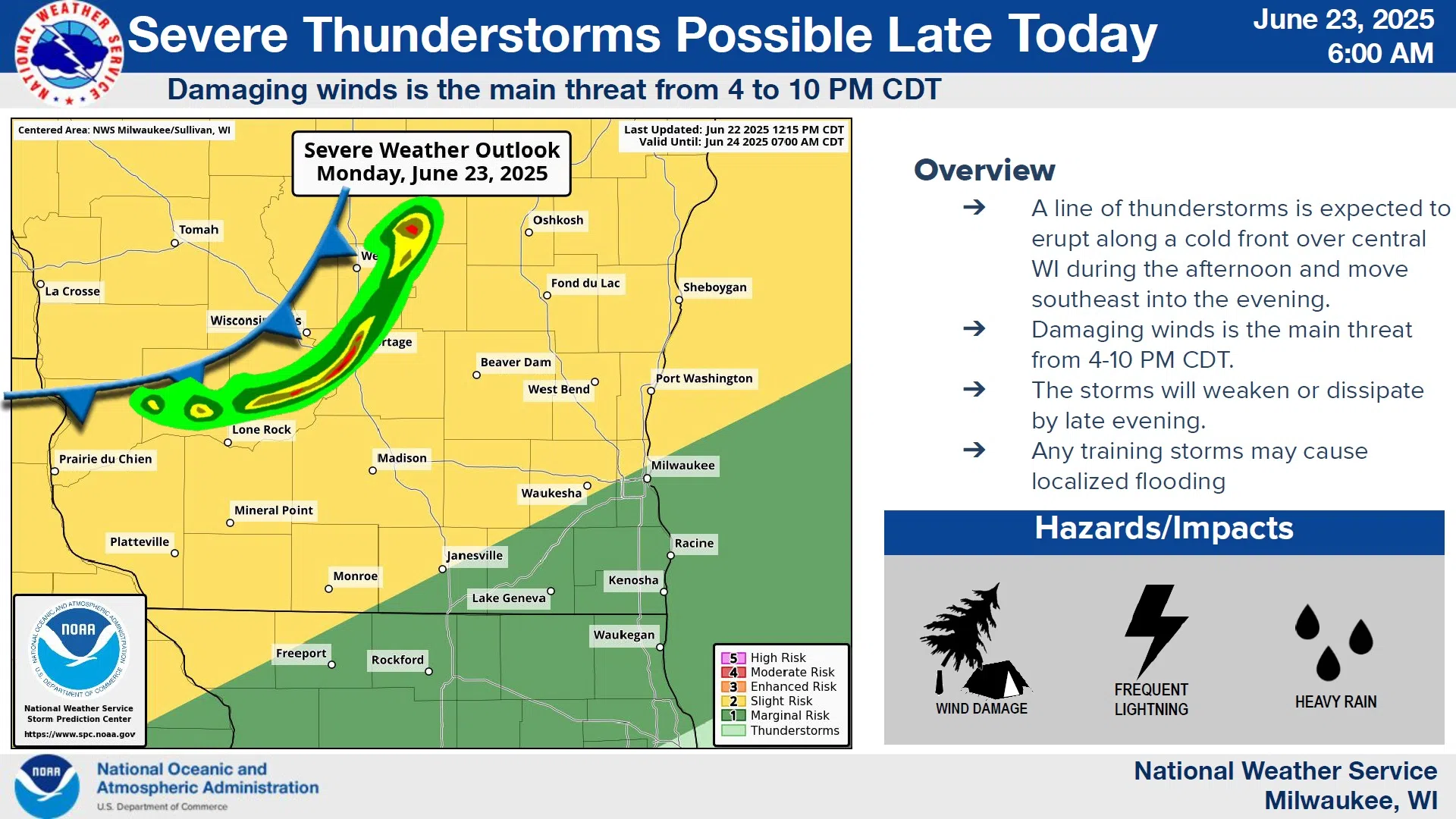
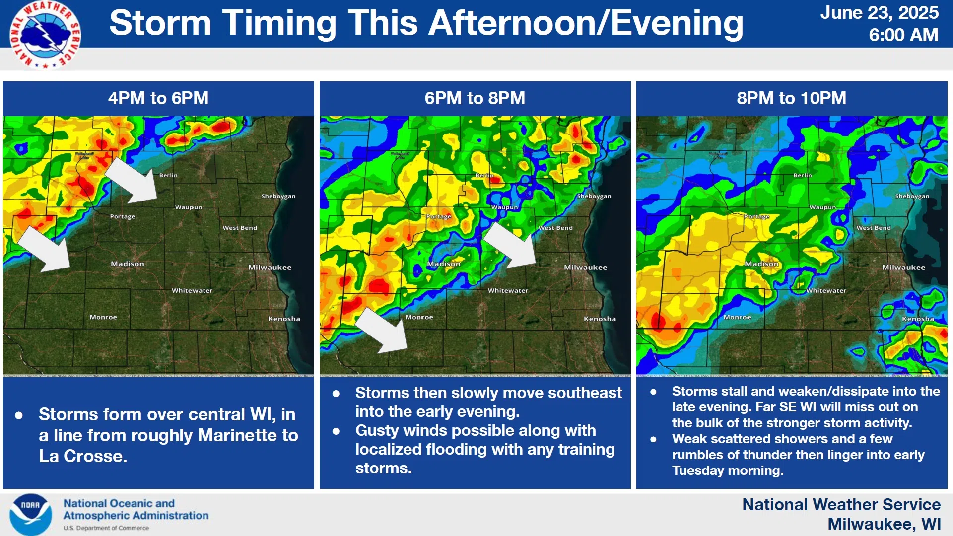
The changeover to better weather could come at a cost, though, as thunderstorms along the approaching cold front are likely to show up by late afternoon or evening. Some of those storms may contain damaging winds and heavy rains, and some localized flooding will be possible if storms repeat in the same areas.
NWS Graphic
Most of those threatening storms should have passed by late tonight, with lingering showers and thunderstorms under mostly cloudy skies expected on Tuesday as temperatures hover in the low-mid 70s.


Comments