As weather factors evolve, the National Weather Service’s job is to interpret and make available the most recent assessments of what’s in store for the public. In the case of Thursday afternoon and evening’s weather, increasing attention is being paid to the chance for strong to severe weather in southern Wisconsin, but perhaps sparing the Sheboygan area.
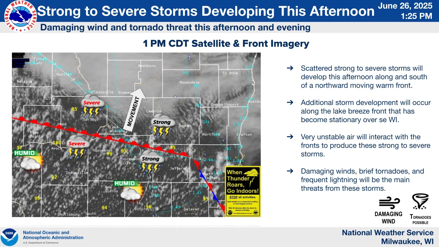
First, the small, but not-to-be-ignored threat of tornadoes has shifted south of our area as the mostly stationary front that was forecast to lift northward has not progressed as earlier expected, and so that risk is of lesser concern here.
Second, given the more recent scenarios, any evening storms that develop will likely weaken further as they approach the lakeshore, limiting the severe potential to areas further to our south and west.
That being said, it’s still possible that we’ll experience scattered storms from now until 6 PM from storms already lined up as of 2 PM along the warm front from LaCrosse to Watertown. Slow northeastward motion would likely affect areas of mostly western Sheboygan County in that batch. A second round between 6 and midnight now looks to be more broken in nature, reducing the risk of some brisk thunderstorm winds, but still carrying the possibility of heavy rain.
After all activity clears by mid-morning on Friday, a partly sunny day awaits with highs in the mid-upper 70s both tomorrow and Saturday, and with hot weather predicted to return for Sunday.


Comments