National Weather Service forecasters are watching what happens over the next 24 hours as a frontal system influences the formation of thunderstorms in Wisconsin.
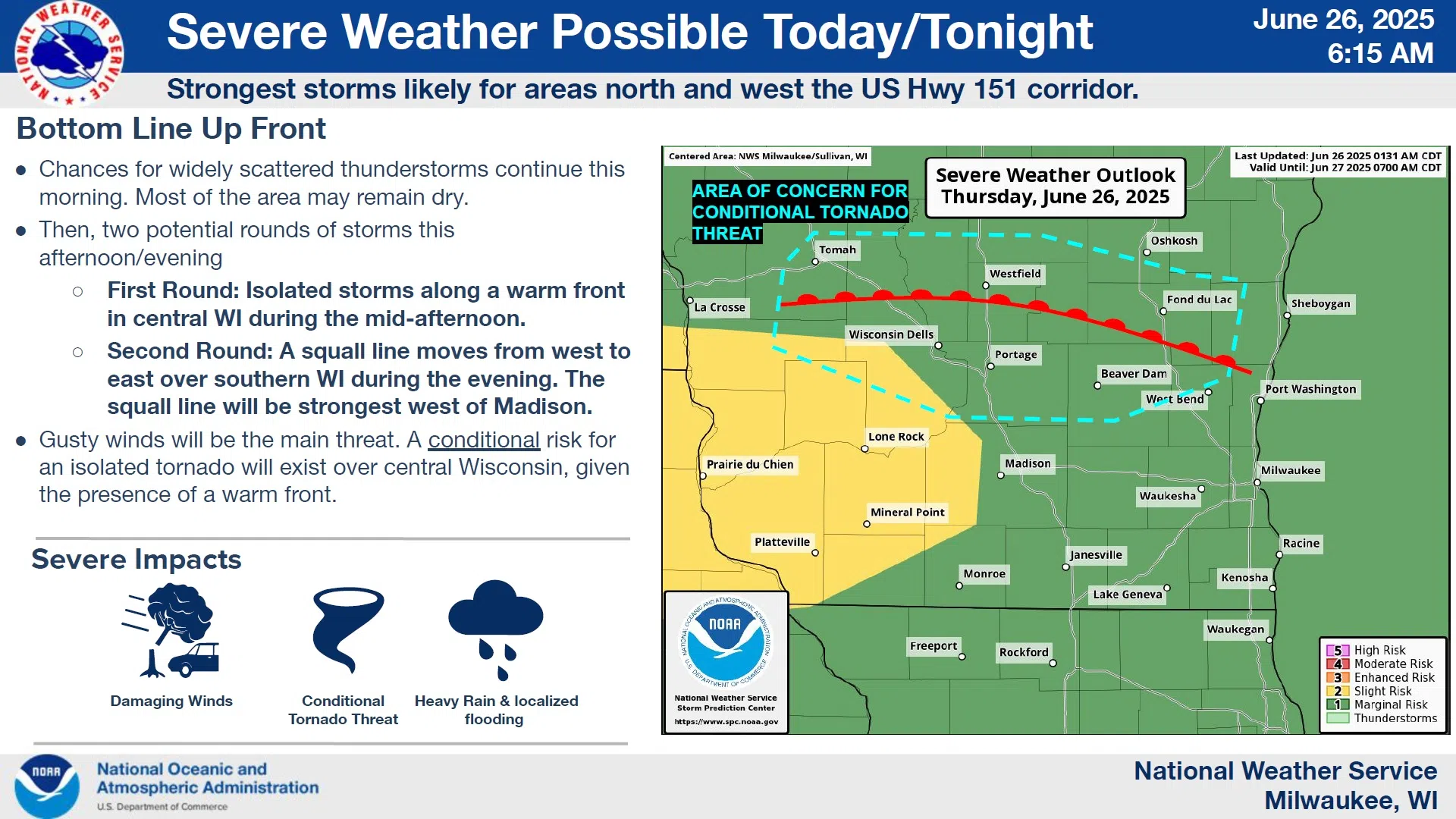
Widely scattered storms could pop up at times this morning, but the timeframe of concern takes place later today.
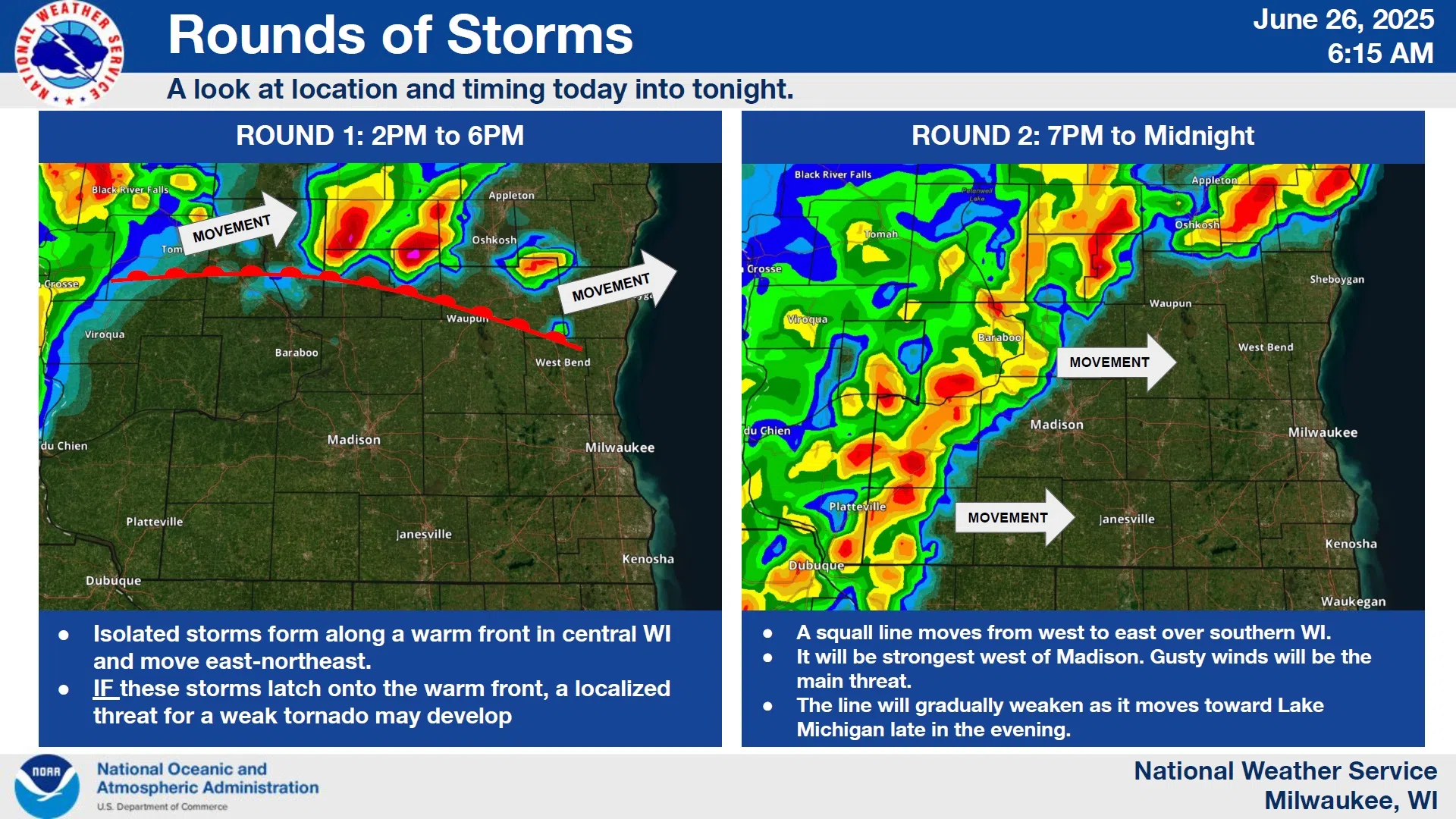
A first round of thunderstorms is expected to progress across the area between 2 and 6 PM, and most of that activity will likely go to our north. However, NWS meteorologists are not dropping their guard as these storms could strengthen if they latch onto a warm front as it lifts northward, and that could produce the tornado threat.
NWS Graphic
A second, more continuous batch of storms in the form of a squall line is expected to traverse most of the state from west to east between 7 PM and midnight. The main risk of gusty winds will be greatest west of Madison, and the squall should weaken as it approaches the Lake Michigan shore late in the evening.
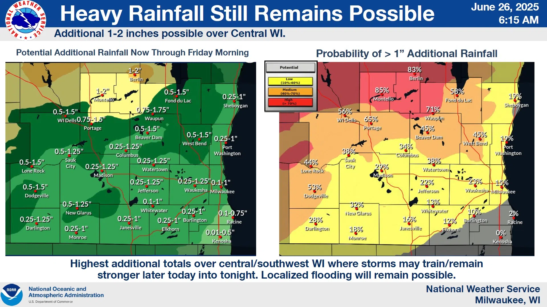
All told, anywhere from a quarter, to an inch of rain may fall. Given the lack of significant rain so far this week in the Sheboygan area, flooding is not likely here.
NWS Graphic


Comments