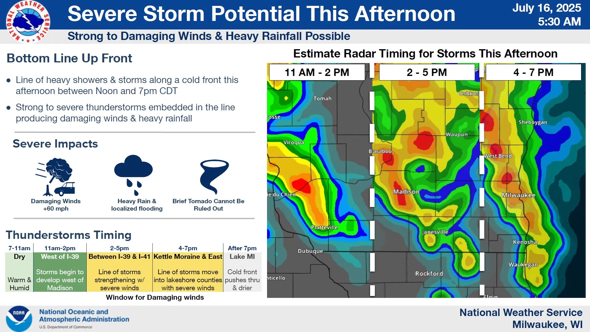
The needed ingredients are coming together that could pose the threat of severe weather in Sheboygan and surrounding counties this afternoon.
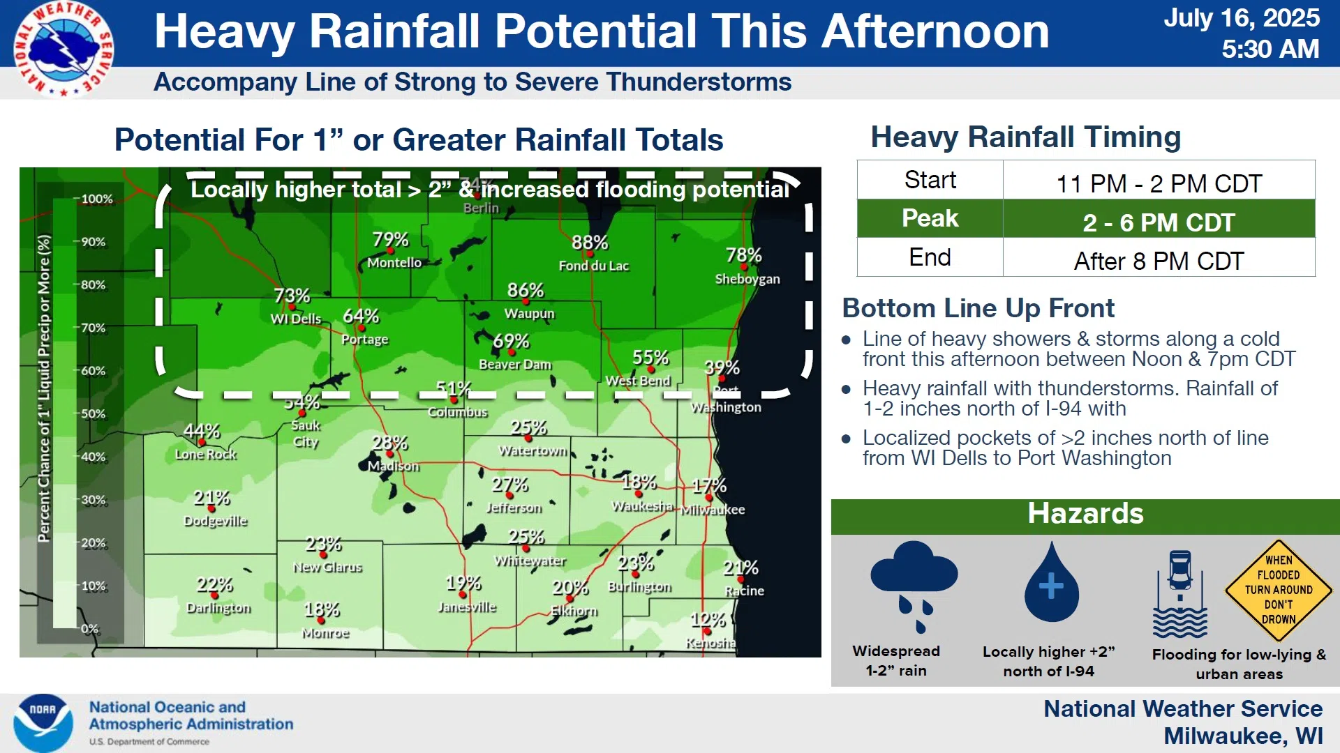
Forecasters with the National Weather Service expect a broken line of storms to develop around the noon hour in Southwestern Wisconsin and then sweep eastward across the state, strengthening as they move and then clear the Lake Michigan shoreline by around 7 PM. Of particular concern is the risk of damaging wind gusts, but a brief, embedded tornado is not entirely being ruled out. We’re also being advised that rainfall of 1-2 inches will accompany those storms, and if storms repeat over the same place, low-lying areas and small streams could experience flash flooding.
NWS Graphic
For Sheboygan County, timing works out to between 4 and 7 PM, and there’s a greater than 75% chance of some localized rainfall of greater than 2 inches. An updated advisory is expected by early this afternoon.


Comments