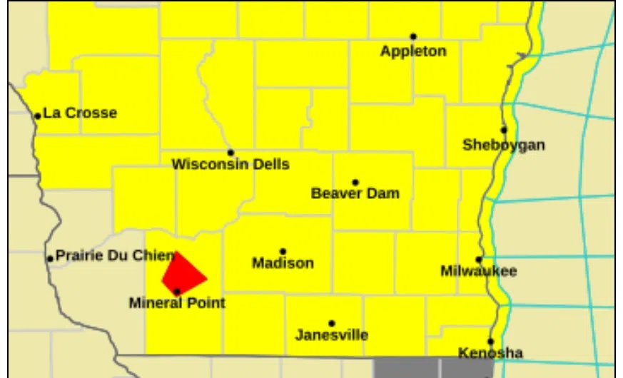
National Weather Service forecasters remain vigilant for the likelihood of bad weather this afternoon. The most recent development is the issuance of a tornado watch that affects much of Wisconsin, including Sheboygan County, until 6 PM.
As expected, a line of thunderstorms was developing in southwestern Wisconsin by late morning, and by noon was approaching Reedsburg and Madison. That line is expected to continue eastward and affect Sheboygan County between 3 and 7 PM.
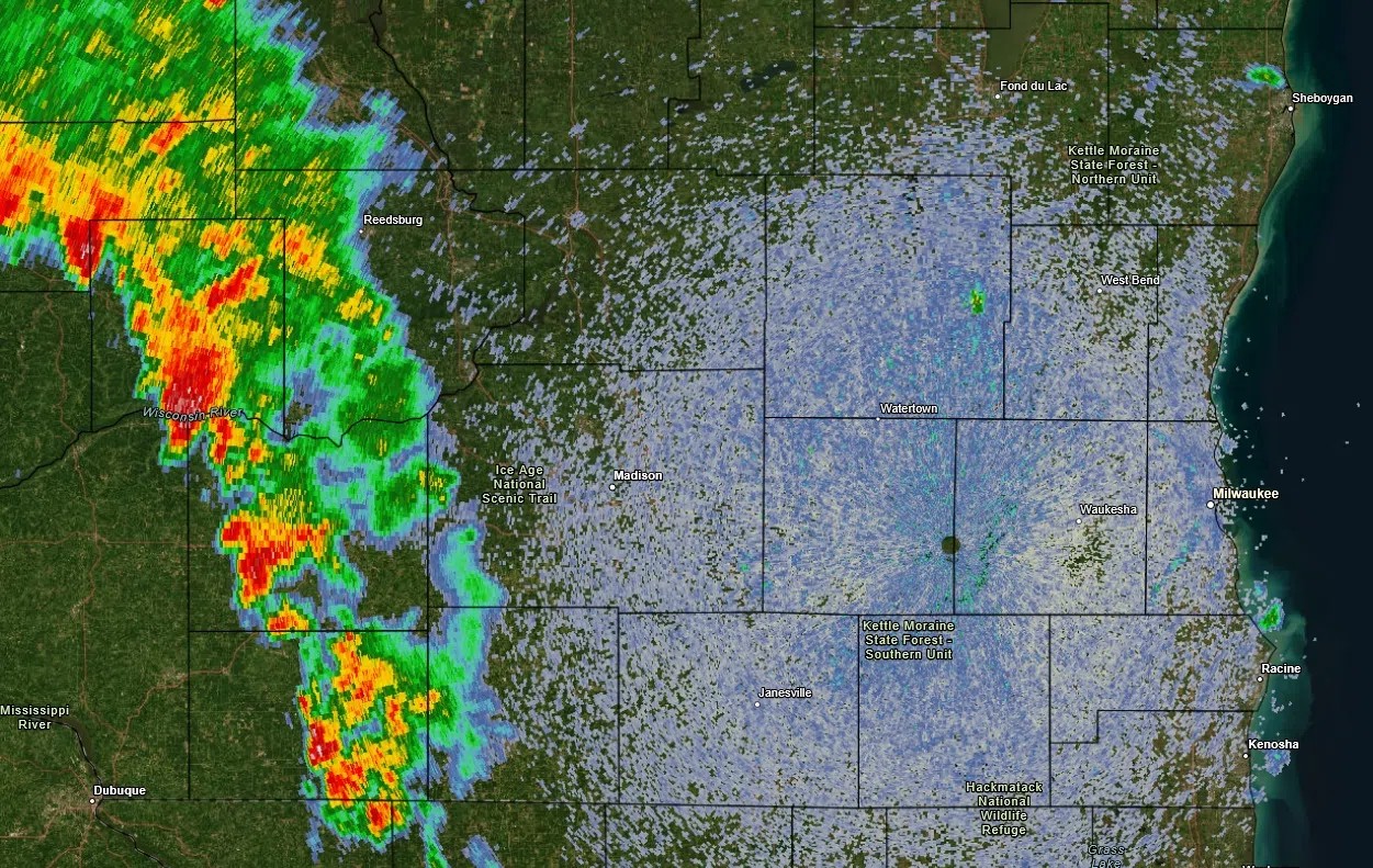
Radar at 12 Noon on Wednesday Shows the Initial Line of Storms. NWS Graphic
Further development is possible behind this line, and the National Weather Service indicated that both the initial, and any followup line of storms, could pose a risk of tornadoes.
The main threat in Sheboygan County – aside from a possible tornado – is that of brief winds in excess of 60 mph as the storms hit, and the chance that rainfall could exceed 2 inches, leading to urban, lowland and small stream flooding.
The cold front responsible will introduce cool, settled weather for Thursday, but until then, the NWS is advising to keep up with developments.

Comments